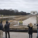
Satellite pictures in Google Maps and, in some spots, Apple Maps suddenly showed whole neighborhoods in Pacific Palisades and parts of Altadena as if the January 2025 fires never happened. People who lost homes saw their houses “reappear” online, and the timing — right in the middle of a bruising mayoral season — set off alarms and conspiracy whispers. Here’s what we actually know, what likely happened, and why the public deserves a straight answer.
What changed on consumer maps
In mid‑May, users noticed that Google Maps’ satellite and 3‑D views for certain Palisades and Altadena blocks had switched back to older imagery. The burned lots and rubble that had shown for more than a year seemingly vanished from the default map layers, replaced by pre‑fire photos that made destroyed homes look intact. Frustrated residents posted to help forums and social media. Some were told by Google support to check Google Earth Pro’s historical imagery instead of getting an explanation. Meanwhile, county and independent satellite datasets continue to show the clear post‑fire damage — so what people were seeing on consumer maps did not match reality on the ground.
Probably a technical rollback — but silence breeds suspicion
The most likely cause is boring, but important: a technical artifact. Maps companies stitch millions of image tiles and 3‑D model pieces from many flights and satellites. When those tiles are updated, cached, or replaced, a glitch can revert the visible layer to older tiles. Mapping communities and experts have seen similar rollbacks before. That explanation makes sense, yet neither Google nor Apple has issued a clear public statement about this mid‑May reversion. So while it’s probably a bug and not a political edit, the lack of transparency fed anger and suspicion.
People in the Palisades and Altadena have every right to be angry. The city’s handling of the fires — from permitting delays to the controversy over $100 million in FireAID disbursements going to NGOs rather than victims — is already a live political issue in the mayoral race. When a Silicon Valley map suddenly “erases” disaster scars, it’s not paranoid to ask hard questions. But technical glitches do happen, and the simplest answer in this case appears to be a broken tile cache or model mismatch, not a deliberate cover‑up.
What should happen next is straightforward: Google and Apple should explain what changed and how they will prevent confusing rollbacks during recovery. Officials in Los Angeles — including Mayor Karen Bass’s office — should point victims to authoritative sources and ensure county damage maps and rebuild data are easily accessible. Victims and reporters can verify reality by using Google Earth Pro’s historical imagery, checking LA County’s post‑fire basemaps, and consulting independent satellite providers like Sentinel or Landsat.
At the end of the day, families who lost homes need facts, not conspiracy theater. Tech platforms must stop treating satellite imagery like a toy and start treating it as vital infrastructure during disasters. And political leaders must do better at rebuilding trust — both on the ground and online. If Google and Apple want to avoid becoming part of the problem, they should come clean and fix the glitch fast. The public deserves nothing less.